Users' Diaries

Recent diary entries

Posted by Luciano on 4 November 2021 in English.

We had unexpected longer downtime last night and this morning.

The render server had some problem (not really clear what went wrong), and needed to be restored from backup (not part of the plan), and then the ogf-carto render was reset (which had been the plan).

Just want to say thank you to the community for your patience.

Those who have been struggling with “render ghosts” - I think they are all fixed now. You can see one really good example here:
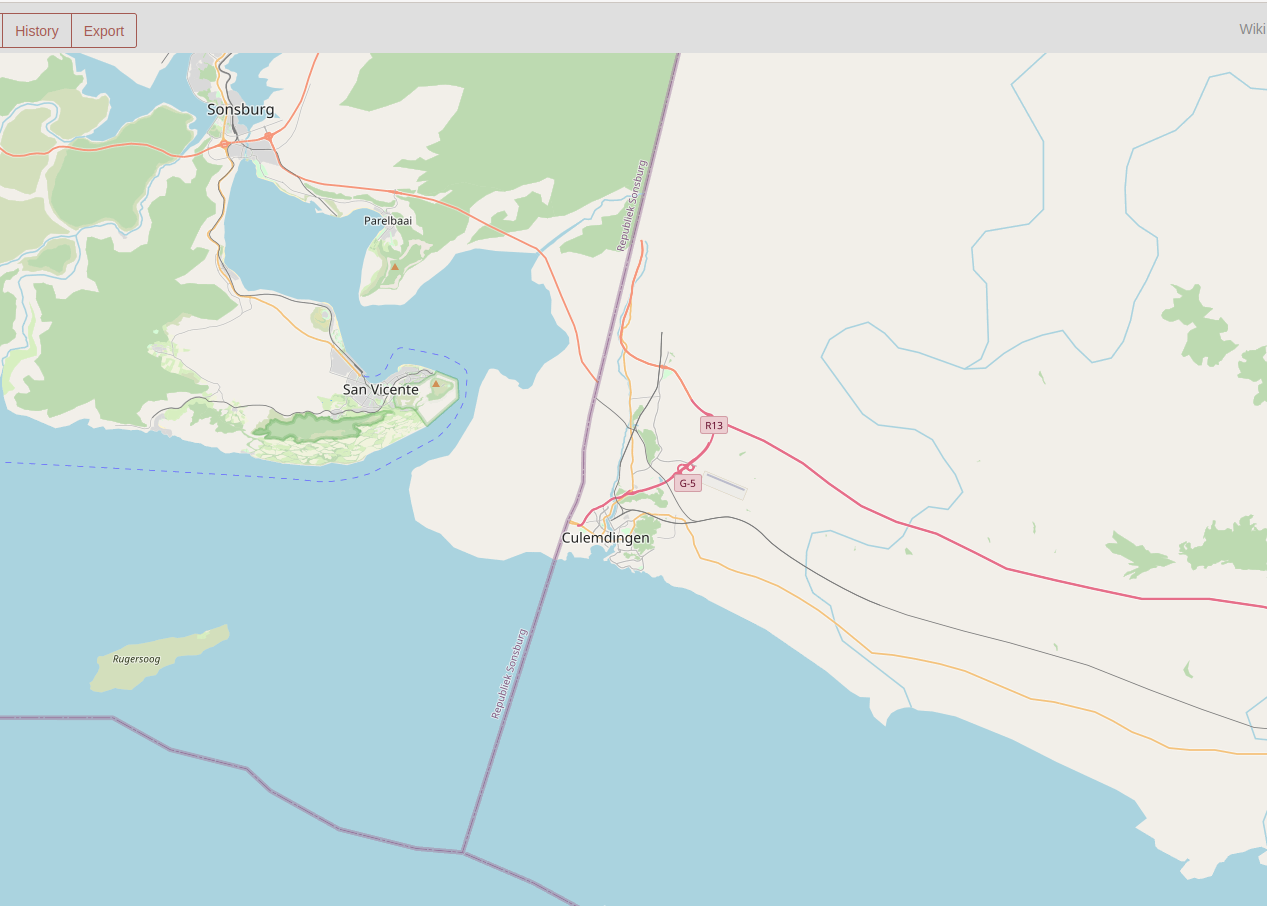
https://opengeofiction.net/#map=11/-17.4132/133.1467&layers=B

map

For comparison, the ogf-topo render still has the ghosts (yes, topo needs maintenance work, I know!):

… See full entry

Posted by pzs111111 on 23 October 2021 in English.

I’m trying to start editing through JOSM, but it always fails to download the data…

The error message was :”Failed to upload data to or download data from ‘https://opengeofiction.net/api/0.6/map?bbox=160.2907192,2.8436768,160.4227551,2.9013968’ due to a problem with transferring data. Details (untranslated): Read timed out”

Do you guys have any idea where the problem is, and how should I solve it?Thanks.

Posted by John1985 on 18 October 2021 in English.

Dear members of the OGF:

After several years as a member of this site I am now departing from a full time role as a member as I now focus on real life work as a baseball player, preparing to train harder to play in Major League Baseball in the United States of America

I am thankful to all of you whose work inspired me to be better in mapping and whose experiences are now inspiring me on my real life activities.

To all, thanks for letting me be a full time part of this site. I hope for the best for OGF for the years to come.

John

Posted by admin on 11 October 2021 in English.

Wiki page: OpenGeofiction:Regular scheduled maintenance

After some discussion among the admin team, we have decided to set up “regularly scheduled maintenance” for the OGF website.

Every Thursday, 4 AM - 6 AM UTC, the server will be unavailable for edits. It might be available for surfing the map or reading diaries or such, but no guarantees.

We will use this time to troubleshoot issues, make sure the server is healthy, and do a weekly reboot to clear out any memory leak problems.

I’m sure there will be users for whom this schedule is inconvenient. I’m sorry - we have a wide distribution of users in many, many time zones, and so it was bound to be inconvenient for some of you.

Local times:

  • US west coast: 8pm - 10pm PST Wednesday
  • US east coast: 11pm Wednesday - 1am EST Thursday
  • UTC: 04:00 - 06:00 UTC Thursday
  • Central Europe: 05:00 - 07:00 CET
  • China: 12:00 - 14:00 CST Thursday
Posted by admin on 8 October 2021 in English.

While we will be unveiling a new territory request process once the wiki relaunches, in the meantime the admin team is now accepting territory requests in Archanta, Tarephia, and West Uletha only. Territory requests in Antarephia and East Uletha continue to be suspended.

All territory requests must be approved by the admin team before editing, and we require that mappers have an established multi-day edit history before having a territory assigned. We also recommend including some basic plans for the territory as part of the request. More information on our territory assignment procedures are available here.

As a reminder, there are also plenty of collaborative projects for mappers to participate in instead of (or while waiting for) a dedicated territory of their own.

Happy mapping!

-Mayor

Posted by mvexel on 6 October 2021 in English.

Hi all, I have started mapping a bit again after a hiatus. Due to my inactivity “my” country has been re-assigned, but no worries I am happy to start from scratch!

I’ve started creating a couple of towns in this area, one along an existing highway I extended a bit, and one connected to the first town only by rail.

My goal eventually is to have a country or region that is entirely car-free. If someone shares that goal I am happy to collaborate on it.

Happy mapping!

Posted by ADB52 on 6 October 2021 in English.

I am detecting problems with the uploads of changesets. Changeset 1139474 is to do with the relocation of the Utterland city of Galmosen to the east by 13 km. As can be seen on the map, there is a section of railway at a crazy angle, which is NOT shown as such on JOSM. Changeset 1134839 contains the deletion of several primary roads and railways in Utterland, which (again) are not shown as deleted on the map. Today, I discovered that changeset 1134798, uploaded by bhj867 served to delete parts of a river that forms the border between Isztianorszag and Utterland, following the deletion of a very large multipolygon of landuse=forest that stretched from Utterland to Pretany. bhj867 has informed me that he did not download data from Utterland. Does anyone else have similar glitches, and could this be looked into. Thanks.

Posted by Luciano on 1 October 2021 in English.

We had some problems last night and today with “certbot” - a tool we use on the server to make sure the OGF webpages are secure (“https”). And that also caused problems with our automated emailing from the server, which supports functions like new user sign up, lost password recovery, and replication monitoring (making sure data goes over to the render and to overpass correctly).

I’m sorry I had to shut down the server without much advance notice - I was worried the problem was worse than it was, and so I was trying to solve it quickly.

Thank you to everyone for your patience!

Also, we have reached the $200 / month level with donations supporting our rental fees for our servers. So thank you to all who have been donating.

Happy mapping and happy (northern hemisphere) Fall.

Hello all,

For backup and analysis i used to download the OGF backup-file and convert it with Osmconvert to clip it to my territory and make it an osm-file. I did this a few times a year and never had problems with it. But now i find the converted files to miss objects.

My first question is on the location of of the OGF backup files. I used to visit the page: http://opengeofiction.net/backup/ but that now gives a Routing Error. From there i looked further and came to the following page: https://ogfdata.rent-a-planet.com/backups/. Is this new page the place to find the backup-files on the OpenGeofiction data?

The second question is about Osmconvert and if there have been updates on this in the past years. The version i used till now, i probably downloaded somewhere in 2015 from this page on the OpenStreetmap-site. I just tried to download it again, but two out of three Windows-links don’t work and the third leads to a Russian page that doesn’t feel right to me. Do others have encountered strange things with using Osmconvert when converting backup-files from the last month? Or does anyone know where i can download the latest Osmconvert to see if my problems can be solved?

Thanks in advance, Antoon

Posted by Fluffr_Nuttr on 19 September 2021 in English. Last updated on 23 September 2021.

Greetings!

After the biannual general FSA ballot, Trombonist2003, Cartograp herKing and I have been confirmed by admin as FSA coordinators, with me being focused on the affairs of the Eastern states.

I suspect quite a few of you have heard of a Stanton “partial redo” from Yoyo21’s previous diary on the matter, however today I bring you a more fleshed out plan. Instead of being divided into boroughs, Stanton is a consolidated city-county made up of 11 wards, each with several hundred thousand people and subdivided into many neighborhoods. They are not meant to be claimed individually- anyone can map throughout the city as long as they have permission. But the themes of the wards can give mappers an idea of where to create what they wish. This also gives Stanton a slightly different identity than our NYC.

And with that, here’s the plan.Credit to infrarrojo

(Disclaimer- the map and these descriptions are all Infrarrojo’s work. Good stuff though and I’m liberally borrowing from him.)

… See full entry

Hello, everyone.

I hope you’re having a wonderful day. More and more work on the wiki is continuing, and we’re hoping for a full launch in the first half of October. There are still a few bugs to iron out, and we’re gradually getting things set up.

If you are a coordinator of an official collaborative, we need your help! All existing collaboration pages have been brought over, but not every collab has a page. If you are a coordinator, please take a look to see if your territory has a page. If not, we need you to create the page! Every collaborative project must have a page that lists the pertinent information (see below).

What if your collab has a page already? Even if your collab does, please take a close look at it and make sure it contains all of the following material clearly indicated at the header:

  • Where the project is
  • Who is coordinating the project
  • What the project is inspired by and the primary language(s) of mapping
  • How to join the project
  • A list of current /active/ members (previously active members should be indicated)

If you are a collab coordinator, please send me a message to get wiki access. Thank you very much, everyone. Happy mapping! ~A