 OpenGeofiction

I’m thinking about a descriptive Wiki page for the Firth of Hetzer, but there are quite a few territories adjoining it, so don’t want to go it alone. An appeal to the owners of Shilesia, Koban, Welstand-Westrijk, Isztianorszag, Vinnmark, Tircambry and Wesmandy, to add to what’s currently a red-link feature.
Diary Entries in English
Recent diary entries

At last the Autonomous Community of Edetanea is acquiring the aspect that has always had in my mind! I’m very happy with the evolution of the territory. Soon I’ll be able to detail the cities, although the old town of Edetanea is beginning to look just like I’ve always wanted. To the east you can appreciate the volcanic summits of Sierra de Cuerna, with the mangroves of Cuerna in the underlying plain. To the north Sierra Espadánea, with the rivers that flow towards the Espadáneo River and the River Royo. To the south the cliffs of Adra, with the city of Adra and the old town on the cliff, next to the mangroves of Adra and the Selva Roya and Selva de Adra. The foothills of Peñas Royas heading from Cuerna to Edetanea… Sierra Murviedra, with its villages climbing the mountains… And Edetanea, the capital, like a gem set in a ring, shining along the Edeta River and the protected wetland of L’Horta. In the next few days I will develop the Edeta Valley, the surroundings of Losilla de los Caballeros and the Paso de Orgeta. I hope you like it and someday make a trip through these lands. :-P Suggestions for business, embassies, etc … are accepted. Happy mapping!
i am confused and worried. I get the feeling that what i do here on OGF seems to be suspiciously similar to what other users are doing. This makes me frustrated, as it makes me vulnerable to accusations of copying peoples work.
And if that happens, i cant say anything against it.
I want to present a case that makes me especially frustrated:
Litvania, and its eastern neighbour, Drabantia.
They are two very similar countries in terms of geography, culture, language and demographics, so for example, the capital cities, Lorava and Odrava, will be very similar. The way that the streets are layed out, how the cities work, what they look like etc…
However, here is the problem:
Whenever something new appeared in Drabantia, i looked at it and said “Damn, that looks nice, shame i cant make something like that.”
This lead to me being urged to either copy it, or, try to make Litvania look just like Drabantia.
For example, if you havemt noticed, as soon as Ráj n/Mlžnicí was finalised, Riekava popped up, and even the presentation in the User Diaries is the same. I was ashamed of myself later, however refused to delete it, as i like Riekava myself. Then, when Drabantia’s owner started rebuilding Drabantia, it happened about the same time that i aswell started thinking about how bad my country looks still after 5 months of activity.
I need help. I am ashamed of myself, and i need some helpful advice as to what to actually do with this situation.
Map updates are running again, but there might be a gap which affects objects created yesterday. If some of your edits don’t show up, please try to apply some change to the affected objects, e.g. by selecting an area and moving everything by some insignificant amount.
If that doesn’t help, or you can’t do it for some reason, maybe because your preferred editor doesn’t support it, or the number of objects is too large, please report it to the admin team, or leave a comment in this thread.

Hello,
So I’m currently in the process of creating a town here. If you want to know more about the town, you can look at my previous diary entries. But, I was wondering if the scale was okay. To the left of the motorway is a commercial area, and to the right of it is a residential area. Do you think that the street “blocks” are about the right size? If not, are they too small, or too large? I tried using that new measurement tool, but it was a bit hard to use.
Thanks!

What countries other than Ingerland were big colonizers? Especially those who might be likely to have had some major colonies in Antarephia and Tarephia?
I ask mainly because of the Woolonia project, which as I mentioned a while back is getting redone. The inside part will become the “Land of the Woolen” nation that will be mostly untouched and undeveloped, but the coast will become a colonized “Woolonia” nation that is more modern (though not super duper modern) with a couple cities and such. I was hoping to find another country other than Ingerland to have been the colonizer.
See:
I guess this is also a result of yesterday’s grand overhaul, but some fairly small changes I made yesterday evening are still not rendering, for example here, in any zoom level…
I was wondering if it snows in my country?
Yes you read that right, for those of you who haven’t edited yet, don’t spend an hour searching for the edit tab, it went missing. I think this is likely because of a maintenace error while they were doing some this afternoon.
Earlier, when parts of the map and higher zoomed in levels were still loading, the newly added directions feature was working just fine, but now it doesn’t seem to want to work. It keeps saying “Couldn’t find a route between those two places”. Anyone else having this problem?
Who wants to co-build a city called Aldeness with me? :D
We need to decide on a location

Hey all, this is an off-handed question because I’m just curious if anybody else is as mad as me, but what’s the densest quality mapping you have all seen in OGF? Like packed in tight blocks of buildings. It’s because sometimes I do worry that the density I work at takes an effect on the OGF servers (though it’s probably not me bringing it down all the time realistically). Also, just because there’s something just aesthetically pleasing to see dense mapping.
- Aces
The OGF research & development department proudly presents our newest tool, the area size calculator:
http://tile.opengeofiction.net/util/relation_area.html
Just enter the relation ID into the “Relation” field at the bottom left corner, and hit “Enter”. Alternatively, its also possible to enter the ogf:area, ogf:id or ref of a relation. If none of these matches, Nominatim will be queried for the name.
This tool is intended to replace the daily generated area table.

OGF will be offline for maintenance on Saturday, April 22, starting at 12:00 pm UTC, for several hours (at least 4, probably).
Taking a break from Opengeofiction to study for my CDL licence. I just got a new job and have to devote all of my energy into prepping for the testing I have to do. I also have a broken laptop screen which hinders me at the moment from doing much of anything on the computer. Will be back soon. Happy mapping guys.

Just a friendly reminder that any person using more than one OpenGeofiction account may be immediately and permanently banned. Please consider yourself warned. Thanks!
Posted by Alejandro24 on 18 April 2017 in English.

Hello mappers. I have many questions about this fictional-realistic world, and it is there are many basic data that are lost in the wiki or not defined at all. I suggest to create pages in OGF Wiki trying to explain many basic aspects of the OGF Planet (from here, OGFp). Anywhere, here are some of those questions:
-
Where are the OGFp? In a solar system like ours or in another with other design?
-
What is the size of the OGFp? The same as Earth?
-
In consequence, are the physical characteristics of the OGFp different from the Earth?
-
What is the name of the OGFp?
-
Do the OGFp have natural satellites?
-
How many oceans and continents are in the OGFp?
-
How the landmasses in the OGFp fit in the tectonic plates theory?
-
How different are the geophysics in the OGFp?
-
Is there any geological history for the OGFp?
-
When did the life surged? Does it follows any evolutive theory?
-
Are we assuming that the habitants of the OGFp are humans or another kind of species?
-
In any case, where did this intelligent species/OGF-humans appeared by first time?
-
Where is the highest point over the sea level?
-
Where is the lowest point over the sea level?
-
Where is the deepest point in the ocean under the sea level?
-
What is the biggest ocean and continent?
-
Where are the northernmost and southernmost points of land? And the easternmost and westernmost?
-
What are in the north and south poles?
-
Where are the most hottest and coldest places and by how much?
-
What is the longest river?
-
What is the biggest dessert? Are other biomes also measured?
-
What is the biggest lake or inland sea?
-
What is the biggest island?
-
What is the biggest glacer?
-
Where are the most remote point of the OGFp?
-
What is the most populated country and city?
an overview of the situation
april seems to be very eventful in real life this year. i havent been very active this past few days, as i was on a trip to London to celebrate my birthday (13th btw).
lots of (new and original) things are scheduled for the rest of this month and may.
a lesson
i learned a lesson:
no one will appreciate or care about my work if i get too inspired and start to copy. thats what i have been doing lately. i got a little weird and started literally copying some users work because i had small amounts of time on OGF, and i could be doing something meaningful with my life, but i also wanted to be perceived as a good and experienced mapper by the community here. i also just wanted a quality country to present.
i already know my work is certainly not astonishing, so i am trying to make a difference.
so now, let me present litvania 2.0
you may have noticed that i have redrawn certain parts of the country here and there, and i now want to focus on Loravia for a few months.
I am aiming for it to be a constitutional republic in the “oh so lovely mountains that i am yet to come up with a good name for”, that makes most of its money from tourism. There will be a purely slavic culture, with some elements of modern art and design in certain parts of it.
Loravia will be a beautiful city with lots of cathedrals and churches and theatres and cinemas and pubs and bars and restaurants and also, some nice buildings like these that i dont known the english name for. The old town is a completely car free pedestrian zone were people can mingle and relax in bars, restaurants etc…
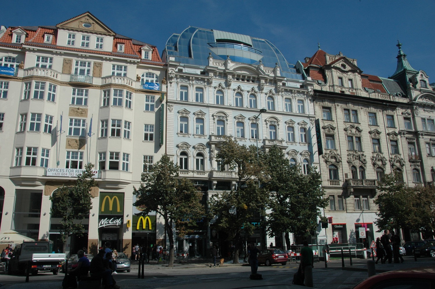
Various tourist attractions will be in the old town, and i will try to make it hve a special charm to it.
Posted by GibranalNN on 18 April 2017 in English.
I would call this continental highway system the AR-oad system.
Here’s a map view intended to help with mapping objects at the right size:
http://tile.opengeofiction.net/util/map_scale.html?pxpt=0.277
You can view the map either at a fixed scale or at fixed zoom, depending on which of the input fields is selected. For the scale to be correct, the pxpt URL parameter (the pixel pitch, in millimeters) needs to be adjusted for your monitor.
Note that zooming by mouse wheel or double-click is disabled, but you can set the zoom by entering a value into the “Zoom” input field and hitting “Enter”.
You can also select the “OpenStreetMap” or “OpenTopoMap” layer for real-world comparisons, and below the zoom control in the upper left corner, there’s also a measuring tool included.