I just mapped something here and it hasn’t shown up.
I am soo confused why it wont render
 OpenGeofiction
I just mapped something here and it hasn’t shown up.
I am soo confused why it wont render
Hi everbody
I’m creating coat of arms and flags for European style countries. You can see all my works in the wikipage of San Marcos and El Ajenjo, as well as the national coa of Allendea and Castellán.
Are you interested in? Send me a message.
I’ve been on this site mapping for a whole year, now, and I think the best thing I’ve created may be this suburb that reminds me of all the terrible places I’m from. I tried to layer different neighborhood street styles from industrial village to streetcar suburb to winding car-centric maze.
I feel like I’ve learned a lot, and that hopefully my mapping has improved over time. Here’s to the next year.
It seems the north pole region is just sea, isn’t it?
I recently watched “The Terror”, a TV series from 2018 about Franklin’s lost expedition, and was thinking about how developed; if in any way, the northern regions of the OGF planet are.
I was thinking about what history it would have, what inhabitants, what ahem failed expeditions I can write about in the wiki ahem, and other stuff.
What do you guys think?
Hello comrades! Here’s a brief delightful message from Antigo.
Will like to ask, how users came to come up with a name for their own territory? I can see sometimes the changes in territory names is partly due to others’ questioning which prompted them to change to more realistic ones (for example Antigo used to be called Rusky, which is just like another name for Russia). How then, after adopting a name, will you then try to give an in-world explanation of the name?
Before ending off this message, the Department of Public Safety will like to encourage all mappers to use JOSM. The Committee of Friendly Relations between People have also urged mappers to welcome the new ones and help them if necessary, just as the Great Supreme Leader T. K. Briarmack has given advice to new citizens of Antigo! All the best to your mapping projects, whether in Antigo or outside.
Message brought on behalf of AntigoRadio.
Hello everyone.
I seem to have reached 2 years on OGF, so it’s time to reflect on my progress as a mapper (just as I have done last year).
What’s happened: - Moving territories (not too far though) - More extensive planning
In general, I feel that I have improved significantly over the past year, though not yet to the level that I would like. Certainly, the only thing I can do now is to practice, and to continue mapping and improving until I reach that level.
One of the most important and positive changes in my mapping this past year is the major increase in my use of external plans. That is, I have been planning my maps better through off-site resources (i.e. paper maps). It’s much easier for me to edit and make any changes to a paper map (in my personal opinion), and it seems to look nice as is (so it’s something that I can keep as well). I think that using paper maps and external planning has been the biggest and one of the best improvements to my mapping so far this year.
I’ve made some great friends over the last year, and I have learned quite a bit from them. It’s great because I can ask them questions and get some more in-depth advice and criticism from them (as they would know the backstory and context of what I am showing them and can ask more questions that come to mind on a quicker basis). In turn, I can do the same for them, and all of us can improve as mappers together.
To sum it up, I have made amazing improvements this year, and I’d like to attribute it to my friends (you know who you are), the use of external planning (which I should have began doing long ago), and the use of JOSM.
I’m really determined to improve my mapping and I’m quite thankful for OGF and the people in it.
It’s time for round 3!
Thanks,
Zekiel
Hey all,
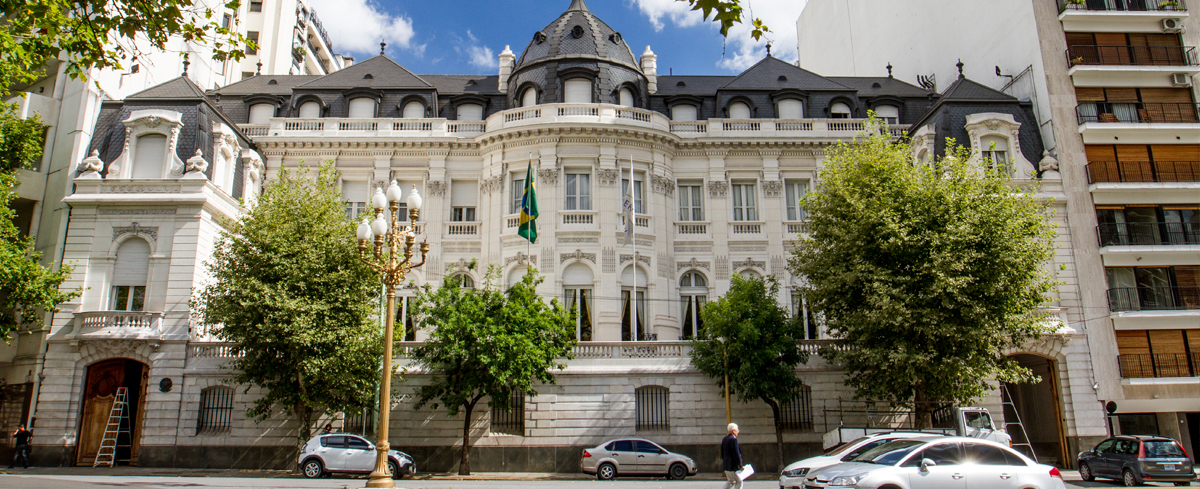
I just want to let you know that embassy sites are now available in eastern Mision, Islatramma. What I have in mind for these areas are colonial townhouses, akin to those in Buenos Aires; See here and here. Please send me a PM with an idea of what you want to make and where, and I can allocate a slot. The plot sizes and layout can be changed depending on what is wanted. Stores, restaurants and cafes can also be built in other parts of the ‘international village.’ I have built some blocks as a guide, but otherwise that side is more of a free-for-all (again, just send me a PM first)
Hello all!
I was creating an old fort in Gobrassanya (this will be moved to my territory once I get one) and do not see the embankments that I added. If you go to edit you will see that there are features that are not displayed when viewed. If you look at this fort in Drull Free State, the embankments are shown quite clearly.
What happened?
I await your responses!
Inventor
I don’t think I’m mapping Teenesccan very well, so I ask the OGF community to review my work.
Should I continue mapping as-is, or should I restart and take a (natural) different approach?
I look forward to hearing your suggestions. Criticism is allowed, constructive or not.
So it’s been a while since I have ever worked on Palaseskia. I have been on a few times recently just to keep me at least a little active.
However, I still have future plans for the nation. Soon, all of the roads and islands in Palaseskia will finally be cleaned up except for some of the northwest corner of the nation so I can start over everything.
I’ve had so much to do throughout time that I haven’t even got to working on my nation.
Anyway, I hope all of you have a great day!
I’m quite new to the OGF community, but I have much longer experience on OSM. On OSM I got quite used to extracting data through Overpass and then editing the desired dataset in JOSM. Since the time I’ve been here on OGF, I’ve tried and constantly failed at doing the same with the dedicated OGF Overpass, only to find out it’s simply impossible. This is because the Overpass server stores no metadata anymore since the GDPR law went into effect, and that metadata is required to edit the dataset in JOSM. But… I found a workaround! I wrote a one click script to extract all IDs from a .osm Overpass dataset into a single list, so you can easily paste this into the ‘Download objects’ dialog in JOSM. JOSM will then download exactly what you previously got as output from Overpass Turbo, and you’re ready to edit right away!
So how do you get this to work? First you have to download your data from Overpass Turbo as you would normally do (‘out meta’ isn’t necessary, ‘out skel’, ‘out geom’, ‘out’, or even ‘out ids’ will all do the job). Then click ‘export’ > ‘raw data’, this will download a file called ‘export.osm’. Next you run the script you can download here by simply double clicking the batch script which will run the other script (which is a PowerShell script). Make sure the export.osm file is in the same folder as the script. The script will run and in a matter of seconds you will have a new file called ‘List.txt’ which contains a list of all IDs, and they’re automatically copied to your clipboard too. In JOSM, paste this list into the ‘Download objects’ dialog. Make sure object type is set to ‘mixed’, and in your JOSM preferences the checkbox ‘Use Overpass server to download objects’ is disabled in the connection settings. Then you just have to click ‘download’ and voila, your data is loaded into JOSM.
I’m using Sterling, Colorado as an example.
Feedback and advice would also be appreciated- thanks :D (It’s not entirely done)
I know my country is appreciated for its landuse style etc. but I have started a redesign of some areas of Älved, which will result in temporary “ugly” placeholders.
My purpose is to make a harmonious style (as Neberly or Ingerland are) so that the map looks great at zoom 8-9 , which I think there isn’t at the moment, so I will redesign and simplify most of the non-precise areas, and when I want to draw precisely a region I will limit those to some “square” regions (see Ingerland and neighboring countries) and not do “semi-precise” areas elsewhere.
I also want to solve verisimilitude problems: some geographic features weren’t logical, as mountain sizes across the country etc., I’m planning to re-align mountains on generally planned mountain ridges, as well.
Don’t worry about bad-looking temporary sketches or “lost” areas (like Norrbunden province), I made a full backup locally and I might put back in place some of the features later. Most “precise” regions will not be impacted by this.
SC.
Full text:
”
Uploading to the server failed because your current dataset violates a precondition. The error message is: ResponseCode=412, Error Header=<Precondition failed: Relation with id 80936 cannot be saved due to Way with id 9828077
”
After searching the OGF-data, I found that:
1.[Relation 80936 is the FSA Land Area (which was changed in my dataset by splitting a way)] (https://opengeofiction.net/relation/80936) 2.Way 9828077 was a coastline way in Arghenna.
Any help here?
Hi there!
Since I changed the name and the location of my country (Montran>Nordmark), please update all yours references to my country, either on the map or on the Wiki.
Also here: https://wiki.opengeofiction.net/wiki/index.php/List_of_country_names_in_various_languages#L-P
I would be very grateful to you!!!
Happy mapping,
W
So, I recently got a new territory (thanks, admin), and there was already the beginnings of a city in it. I decided to re-purpose this as my capital, but BOY are these streets a mess. I’m not sure what the previous owner was thinking. Even using them as older-style, European-type streets that got their beginnings as pathways still requires loads of straightening and reconnecting and such. Also, there are no names, which is something I have yet to rectify.
Should this really be here? I was looking around history when I found it. In a do not edit and the person who did it had no other edits made.
I’m currently mapping a commercial area downtown and would love to see restaurants that represent different cultures. However, despite some detailed description of cuisines of several countries (like Kojo), there is just a general lack of idea of what people in each country eat.
I’m not encouraging overwikification here - As this is a necessity for commercial development - so, if you have an idea, describe your cuisine in just a few sentences, so that I - and possibly others on the same path - would get an idea of what restaurants to put, instead of just fast food, y’kno.
I looked at some in my city and one of them is marked under commercial and the other one isn’t. I’m quite confused which landuse fits with a Recreational Complex.
HI fellow mappers,
This is not a post to criticize anything. I just want to congratulate everyone on what you have done. If you have not already, just take a second to look and see what you made. It is a really good feeling to see what you have made and what it looks like! Anyways, keep mapping and making this world better and more detailed(remember - details matter!).
Regards, oof boi