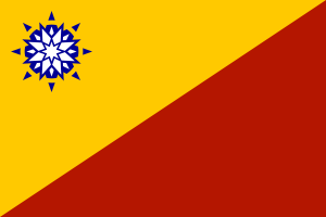
I’ve been working on Lake City in the FSA state of Minnonigan for several weeks now, and I noticed one of my neighbors to the southwest… Compare downtown Lake City to downtown Greenstone.
I’m flattered.
 OpenGeofiction
I’ve been working on Lake City in the FSA state of Minnonigan for several weeks now, and I noticed one of my neighbors to the southwest… Compare downtown Lake City to downtown Greenstone.
I’m flattered.
Hey guys!
Is there a way to make it so you can make large changes to the map, (making large highways, etc etc.) quickly? I don’t have JOSM, so are there any ways to do it quickly in ID or Potlatch?
Thanks, GeoMaps
Hi all. You most likely don’t know me or remember me, if not, well, hi! I am GeoMaps, an inactive editor who owns a nation named Ferran, based on France. I have been inactive for quite some time now, and I just wanted to state the future of my nation.
Well, enough talking, let me tell you the future of my nation, Ferran. _________________________________ THE FUTURE OF FERRAN: My nation, Ferran will most likely stay on the map. I hope to get back into editing the nation and making it into a detailed place. I am bad at making a realistic city (even after reading the tutorial on the Wiki). I will try my best,a nd try to look at other cities for inspiration. I wanna come back to this community after being gone for quite some time gone. I hope to see you all again! _________________________________
The founder of Ferran, GeoMaps
Hi, guys, I’ve been editing at the island part of Commonia. I’ve started on a small town called Truabury and made another island (small) for mountain-like landscapes. But, whenever I look at it (view), it only shows the name of the island but not the island itself. Is there something I’ve been doing wrong?
I’ve also added an administrative boundary and have followed everything the administrative boundary of Saporti has. It still doesn’t work.
-Thanks, iiEarth
~
MOTORWAYS: M0 - Rheimhaavn City Ring Motorway M1 - Rheimhaavn (Tottenvigg) - Baaboor - Staaghwich
NATIONAL MAIN ROADS: A1 Cental Highway: Rheimhaavn - Suurpunn (via: Baaboor, Staaghwich, St Hedwig’s, Darraogh, Y’stadth, Fluuth, Oornaveeg) A2 West Coast Highway: Rheimhaavn - Afon (border) (via: Bennporatt, Mountainview, St. Anne’s Bay, Herring Bay
Is there any way to measure distance in iD?
Thank you for your answers!
Konlami is a picturesque town nested at the edge of the Tasmal Mountains. It has 3 major highways: YA 61, National 17 and exits 24 and 24B towards A 2. It is also about 20-30 minutes south of Margenson. Milaukáshka and Ominoso are also within 90 minutes of Konlami. I believe it is by far the biggest and most successful project I have ever made. I can also declare that Renpuma is a failed project compared to this. I plan to have about five neighbourhoods of similar size. Neighborhoods 1 and 2 are complete and Neighborhood 3 is currently a work-in-progress. Neighborhoods 4 and 5 are coming soon. Upon completion, it is expected to have a population of about 10K. What I need from you is your opinions on Konlami.
Hi guys, I have another problem which has been bugging me for the past few days. There seems to be 4 capitals for Commonia.
Can I please know which capital is the actual one or are all of them the capitals?
Thanks!
Hey there mappers,
Hope you’re all doing well!
I had a lot of requests for Embassies in Ascot and I know there are already some ascottish Embassies built around the OGF world.
Because Ascot is heavily under development I had not the possibility to build all this embassies. Because of that, I decided to make a wiki page for embassies in Ascot, theres a waiting list for embassies on the bottom of the page, so if you are interested to have an embassy or consulate in Ascot I would really appreciate if you would join this wiki!
I know from a few persons that they built Ascottish Embassies in their Countries, if you are/will be one of that persons I would also really appreciate if you would join the other wiki for ascottish embassies in your countries.
thank you guys!
Have a nice day and happy mapping!
Lars
Hi Mappers, Recently I’ve been working on the city named “Cheung Kwen O” City. As you may see in the following link, the city pretty looks like Kowloon, Hong Kong, in late 80’s. The city is not yet finished but I have to take an exam in near future so I won’t be active for a month or two. Hope will see you guys soon~ Feel free to drop some comments :)
Hello again,
I would like to know how to input refs and where to input them
(Ref=tag)
Thanks
If anyone would like to help, send me a private message telling me you want to help. The entire island is a bit hilly and a bit mountanous in the central areas. Cities are semi big but not too big. Central cities are much smaller and curvier due to the constant hills and mountains. The highways are always by the coast due to the incline of the mountains being either too steep or theres cliffs around to not fit a car or truck.
If your interested in helping me with this project send me a private message, and your discord tag (user#6969) for example. so we can talk.
Also i’d like to do maps of the elevation of montaga
I’d like to know
Some of you may have noticed it already, but Řots is rather empty at the moment. Apart from a few densely mapped areas that I will keep, I removed the basic mapping in the rest of the country in order to remake it. The country’s language will change as well: instead of Řotsnan (which I found increasingly annoying to use) there will be another conlang called Xseget. This means that the country’s name will change as well, into Xsegunis. And while I’m at it, the political/societal setup of Řots will be overhauled as well, so basically it will become a completely different country, but on the same location.
Regarding the mapping I made a setup this time (I never did for Řots), and there is this wonderful feature in JOSM that allows you to import your own map as a background so that you know where you are drawing. Unfortunately JOSM and I have been at odds basically since I started working with it (one day it works, the next it doesn’t, and to get to the point where I know if it will work or not in the first place usually takes me at least one hour), so I’ll have to figure out a solution for that.
I will put the diplomatic relations that Řots had on hold for the moment. Nekkar is not the capital anymore, so embassies will have to move; the new capital is Rwynuk Swxytsahocsunav (Rwynuk for short), which will be developed in due time.
~
As the map below would show, I am currently in the middle of a project: to essentially design the Central Business District of the urban region of Xenica. (It doesn’t officially have a name, most locals just call it ‘the city’).
My progress so far has been quite slow, due to mapping most things out at level 19, where I am adding buildings, paths, and green spaces. However, that is not my concern at the moment. My concern is the street grid.
As you can see, the streets in the centre of the grid have been mapped out using the ‘tertiary road’ classification, and are the same width: however, I don’t feel like this cuts it for me. My main inspiration for this project is the centre of Saint-Denis, in the French Overseas Department of Reunion, which features buildings arranged in a similar manner to Xenica: it was a choice made on account of the fact that Reunion is a similar size, and population to Xenica. However, the street grid features different widths of road, and the centre of the street grid does NOT use ‘tertiary’ classification.
So, which classification should I use then? Is it ‘minor road’, or ‘residential road’? Or is it something else?
-Jake
Today is the 53rd year since Singapore was expelled from Malaysia and gained its independence. Between last year and now, I have gone through quite a journey in OGF. Well, not going to describe my journey, since it will mean writing much more. Basically, I have been unbanned and banned again from the wiki, totally abandoning my country of Singkangia and decided to take a new step in mapping the dictatorial nation of the PFS, or Antigo.
Taking someone’s suggestion, I decided to create a blog to detail about my mapping progress in that nation. This blog isn’t really anything like the blikis, but check it out yourself if you want.
https://mdiantigo.wordpress.com/2018/08/09/the-journey-begins/
Today is also Antigo’s Liberation Day, the day when an armistice was signed 79 years ago between Antigo and Pretany to cease the war between the states. Since then, Antigo has been de facto independent of Pretany. This date has been agreed between me and bhj867.
By the way, also thanks to all who commented in last year’s diary entry. It really gave me an insight into what other nations celebrate.
Is there an “origin” country, i.e. Ingerland for Ingerish, but for Franquese?