 OpenGeofiction

Deleted Diary Entry :I
Users' Diaries
Recent diary entries
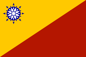
Given the extremely terrible human rights and economic situation in Antigo (I will spare the details for now), a handful of Antigoans will try to sneak out of the country. Only quite a few managed to survive the crossing (given the fact that our borders are well protected), and even if you cross to Pretany or any of the other two (unmapped) neighbours, they are not so friendly in letting you stay for too long (Pretany often treats Antigoans as second class, which is why Antigo prefers to keep out of Pretanic rule. Suria may not be, while Mazan is not a good place to live in, with arid deserts). The best bet for successful Antigoans who get out can seek refugee status at the AN office (is there a refugee one like the United Nations High Commissioner for Refugees? Maybe I will ask bhj867 to map one.) in St. Richards (just across the border), and hopefully get to somewhere far from the regime all out to bring them back. (Watch out for the Antigoan spies!)
So, the AN may need to consider a few safe sites for resettlement of the Antigoan defectors. Will you set aside space in your city/town/country for an Antigoan District? It can as small as a few blocks, but doesn’t need to be so large. It needs to be well protected as well, lest spies will suddenly raid the blocks and take out the Antigoans, so there needs to be a police station. Any country unfriendly to the regime is also welcome (lessen the chances of spies infiltrating).
Zhen Kang (Z.K.)

Hello OGF community! My country is in development and I am planning administrative divisions. When dealing with the traditional editor it is a bit complex, but I feel that with JOSM they can be done more easily. I await your opinion on how to create them.

Good morning! (If you live in the U.S.) I am CharlieG of Artenia, a country around the size of the UAE/Israel. While not present, Artenian buildings and coastline protection are built to withstand earthquakes and tsunamis. These are real occurrences on Earth and they should be brought to OGF, no matter how devastating. I cannot seem to find any support for the idea of the OGF world including fault lines, but I’m sure something could be worked out (maybe on a third-party platform). Earthquakes and tsunamis would drastically change coastlines and building structures throughout the OGF world, so lots of effort and brainstorming would go into this process. But, I think we could all work something out about this issue. I am ready to add coastline protection to my country’s coast, and you should too! Thanks for your understanding! -CharlieG
Does this town hall look realistic?
Me and Dudemap555 will be making a new town, named Outcoast between Milatichi city and the tip of the Great Spooky Woods.
We would like some help with generally scaling it and expanding it.
It would also be great If we could get some tips for making the town to the best of our abilities.
Thank You,
And As Always Happy Mapping!

Given the fact that I live in Alaska and there seems to be no area similar to it in OGF, this question came to me: is there interest in making an Alaskan-type island in the far southeast of Archanta? The territory would be part of the FSA, and could probably be a collaborative effort that focuses on mapping more natural features over large cities. (Although the Southern Islands seems to have the same objective, it looks to be more of an Antarctic comparison.) Thoughts?
A height map is a gray scale image that resembles a terrain elevation contour map. They’re used for creating 3D image renderings of part or all of the world (real, OGF or otherwise) as well as to run planet-level simulations for stuff like climate and weather. For the real world, it’s easy to get a height map - you can even create one from OpenStreetMap with this utility.
For the OGF world, of course, things are trickier because we don’t have a world-spanning topo map. It looks like a little 3D rendering had been done on the OGF world before I joined, but I couldn’t find any height maps. Anyone know if one is accessible somewhere?
(Aside: such a map could never be canon, since anyone is free within reason to e.g. tear down or put up a giant mountain range inside their country. But by noting where mountains have been placed on the OGF map plus some creative guess work it should be possible to make a plausible one using a utility such as HME.)
Thanks in advance and if I can create or lay my hands on something, cool maps and images may follow…
i created a large lake southwest of centen called big lake. it is a nature reserve and recreational area with beaches, camping, a historical town, and many more. i request nobody but me edit that area even if commonia is a blue country.i dont have any further plans for the lake at the moment but mabey i might have some plans later.
Me and my friends have created a city named Centen.
Our city is not bad, located near some lakes, and has some stuff, including a train system, and others.
We need help!
We need some help with Centen! In the comments, Give us a judgement of Centen, plus some suggestions! You can help build the city too!
SCALING ISSUES
THERE IS A MASSIVE ISSUE WITH SCALING. a house in Centen is bigger than a FOOTBALL FIELD. We need help with this!

Hey everyone,
It’s been over a year since I posted a diary entry so I figured I’d let people know what I’ve been up to. I just finished Patriotland International Airport. Is the airport missing anything? This is my first attempt at mapping an airport!
In addition, I’ve been working on some harbor towns such as Port Perrine and Gundock. Both of these towns are inspired by older suburbs of Philadelphia, PA in South Jersey along the Delaware river. The block style is typical of this area, and implies thin, deep row homes with alleys behind them. The shore of Patriot Harbor is quite working class, situated near a lot of industrial sites.
Here are the long-term plans for my territory.

I would be interested to hear what you all think of my work so far, good or bad. I have so much more planned in my head, it just takes years to get it all mapped correctly. I map differently than most people, focusing on one small area at a time.

Hi everyone!
I’m creating a union whose name is Lyc Union between Antarephia and Tarephia . This union is supposed to be like an European Union. There will be free borders, a parliament… All territories near to this place of the world are welcome to join it. Also autonomous and overseas regions.
Are you interested in joining to it? Send me a message
Bye!
Wikipage: https://wiki.opengeofiction.net/wiki/index.php/Lyc_Union
Hey Guys and Gals and everything in between,
I’ve been doing some work around my capital city, Mision. It’s a city based on a mix of Buenos Aires and Barcelona. I’m new to all this worldbuilding stuff, so I was wanted to ask for some honest feedback on the work I’ve been doing.
When I say honest, I mean HONEST.
Anything big or small that I’m doing wrong or right would be greatly appreciated.
Thanks
[EDIT: I mean more the southern end of town, and more on the layout and design of my roads.]
Posted by SwissCrusader on 26 March 2019 in English.
So it’s been approximately 1 year since I joined the adventure, and I can say I reached an impressive amount of work. So how did I make it ? Was I in a cave, mapping my mountains all this time ? Let’s find out.
I’ve done worldbuilding for quite some time in my life, building worlds out of my dreams or my imagination, for RPGs maybe, or city building games, or just because they self-generated in my head, occupying a large space and I needed them to come out, as would a musician with his music or a painter with his paintings. I was an OSM contributor too at that time. When I discovered Opengeofiction I thought this was the place to put all the things online - I just had to adapt it to the few etiquette rules and the modern world verisimilitude constraint there - so within the piece of land I was granted I began to create a country that fits both OGF environment and the places I had in mind.
So how did I manage to do this so quickly ? The answer is only one letter: “F”. Yes, “F” is the key to quick mapping achievement. In JOSM it does miracles.
Älvedic Union is inspired by Switzerland (it was Älvedic Confederacy at first), but also Austria, Hungary, Western Ukraine and let’s say Eastern Siberia, the political and linguistic situation is very complex and unstable, and the country is rather poor and underdeveloped, but improving since fret traffic between the south and Neberly crosses Älved. For more info about the country, like what is the inspiration, where do the names come from etc., check Älved on the wiki.
+++++++

Well it appears that since new territories have been created and inhabited it appears that new motorways have also been laid out. It appears that recently granted territories have motorways mapped on them before any natural feature or even a mere surface route.
I don’t understand what the infatuation with a motorway is anyway. They are expensive to build, take up valuable real estate and they also contribute to blight and sprawl. Having said that I know that they are a necessity in a country that needs to move goods and services.
Hi, I would like to grant a large territory in North Archanta to two, or three, users for them to collaborate on a South Africa inspired country.
The territory would be within the boundaries of AR066 and AR018, although not necessarily the complete combined area.
I want the users to find each other, build up a proposal and submit that to admin (subject: “AR066/AR018 proposal”). Each proposal will then be explored.
Proposals will need to comprehend the complex geography and linguistic challenges of such a territory.
Deadline for submissions: Friday 19 April.
Thanks/L
Aslington is easily one of the more well-known parts of Vodeo. Embassies jostle for space among all manner of stores, apartments, and Adelaidean-era houses. Latinian ex-pats wave at their Myrcian neighbours, while the local Mauroi population sit in front of the YemYem! and scream at passers-by. And to top it all off, there sits Parliament upon the riverbank, anchoring the Dominion and providing somewhere for politicians to blow off some steam at each other.
But all is not perfect in Aslington. The suburb wasn’t designed with angles in mind, and as a result, the grid is lopsided and doesn’t form nice angles. It might sound like a minor thing, but it means that buildings (a lot of which are just too small) don’t easily align to the streets, and that just annoys me. I’ve tried to tinker with it in the past, but there’s only so much I can do given the number of buildings that have locked the streets in place. So, I’m planning to tear it down and start again. Here’s what I’m thinking:

Hello OGF friends! I am the owner of Déserts, in Archanta; and I’ve been getting involved in the international arena. I have seen that there is an Archanta Nations Organizations (which sounds more like the OAS), but at the moment it has no headquarters; so I ask, can it be established in any country? and another is there any other organization in Archanta, apart from CARECU (which plans to join the ARNO)?
A few days ago, I had sent an application for a state in AR120. I’m not complaining about the timeliness of the response, or lack of, but rather the fact that it has failed to show up in the status of applications for South Archanta. This worries me, and makes me think something I did in the app was wrong. Can somebody tell me what I did wrong, if anything?
Hello mappers,
I’m here to ask something: how do we tag capitals for best rendering?
Typically the state capital is tagged with capital=yes, but histor-style and TopoMap styles take into account the admin_levels of capitals. OSM wiki proposes that for state capitals, capital=yes should be used, but for province capitals, we should use capital=3 or capital=4, etc.
But on the OSM wiki it is also mentioned that we can combine capital=yes and admin_level=3/admin_level=4/etc. tags.
Also, sometimes I’ve seen tags like capital=2.
So which one of them is the most correct (for OGF)?